

Walking Route Planner
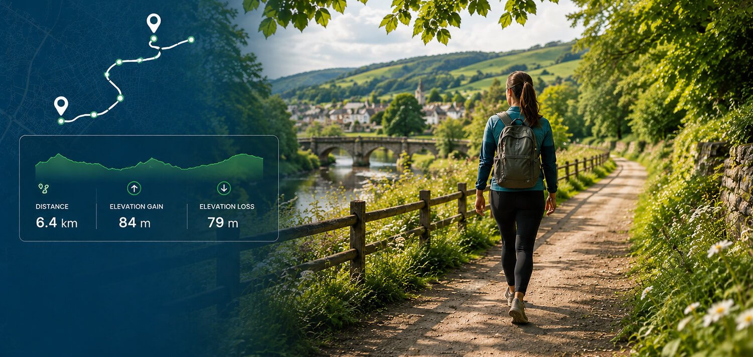
Plan your next walk with Map My Distance’s online walking route planner. Create a walking route directly on the map, calculate the distance as you go, check the elevation profile and adjust your route until you’ve planned the walk you want.
Whether you’re heading out for a short daily walk, planning a longer weekend route, exploring somewhere new or simply trying to reach a distance goal, Map My Distance makes it easy to map your walk before you set off.
Everything You Need to Plan Better Walks
Map My Distance gives you simple tools to map, measure and explore walking routes before you head out.
Map Your Walk
Create a walking route by adding points directly to the interactive map.
Calculate Distance
See your total walking distance update as you build your route. Km or miles.
Follow Roads & Paths
Snap your route to available roads and paths for more realistic walking routes.
Check Elevation
View the elevation profile to understand hills, climbs and descents along your walk.
Save Your Walks
Save your favorite walking routes to your account and find them again anytime.
Share & Collaborate
Share walking routes with friends or plan your next walk together.
Add Points of Interest
Mark landmarks, meeting points and useful locations along your planned walk.
Works Worldwide
Plan walking routes around the world with global mapping coverage.
How to Plan a Walking Route
It only takes a few clicks to map your next walk.
Choose Your Start
Find where you want your walk to begin on the map.
Add Points
Add points along the roads and paths you want your walk to follow.
View Distance & Elevation
See live distance and review the elevation profile.
Save & Walk
Save your route, share it with someone or head out and enjoy your walk.
Plan a Walking Route Online
Planning a walk in advance makes it easier to choose the distance you want to cover, understand where you’re going and discover new places along the way.
With the Map My Distance walking route planner, you can create your route directly on an interactive map. Choose where you want to start and add points along the roads and paths you’d like your walk to follow. As your route grows, Map My Distance automatically calculates the total distance.
You can use the walking route mapper for a quick walk around your neighbourhood, a daily fitness goal, a longer weekend walk, sightseeing while travelling or simply exploring somewhere you’ve never walked before.
Instead of guessing how far you’ve planned to walk, you can map your route beforehand and adjust it until the distance works for you.
Map Your Walking Route
Creating a walking route with Map My Distance is straightforward.
Start by finding your location on the map and choosing where you want your walk to begin. Add points along your planned route and watch as your walk takes shape on the map.
If the route is too short, extend it by adding another road, path or loop. If it’s longer than you wanted, adjust your points until you’ve created the right route for the time and distance you have available.
You can use Map My Distance to plan:
- Everyday neighbourhood walks
- Fitness and exercise walks
- Dog-walking routes
- Circular and loop walks
- Longer weekend walks
- Sightseeing routes
- Social and group walks
- Walks while travelling
- New local routes to explore
Whether you’re walking for fitness, relaxation, transport or adventure, planning the route beforehand gives you a clearer idea of where you’re going and how far you’ll travel.
Calculate Your Walking Distance
Wondering how far your planned walk is?
Map My Distance works as a walking distance calculator, automatically measuring the length of your route as you create it.
Every time you add or adjust part of the route, the total distance updates. This makes it easy to create a walk around a specific distance rather than relying on an estimate.
For example, you could create a quick 2 km walk during a break, map out a 5 km fitness walk or plan a much longer route for the weekend.
If you’re working towards a daily or weekly walking-distance goal, you can also create several routes of different lengths and choose one based on how far you want to walk that day.
Distances can be viewed in kilometres or miles, allowing you to use the measurement that works best for you.
Plan Circular and Loop Walking Routes
Sometimes the most convenient walk is one that finishes where it started.
You can use Map My Distance to create circular or loop walking routes by mapping a route away from your starting point and then bringing it back around to where you began.
As you create the loop, your total distance updates so you can keep extending or shortening the route until it’s close to the distance you’re looking for.
Circular walking routes can be particularly useful for everyday exercise, dog walks, weekend walks and exploring a new area without having to arrange transport back to your starting point.
You can also experiment with different streets and paths to turn a familiar local walk into a new route.
Follow Roads and Paths
A useful walking route needs to reflect where you can actually walk rather than simply drawing straight lines between locations.
Map My Distance includes route snapping to help your planned route follow available roads and paths where routing data is available.
As you add points to your walk, you can create a more realistic route through neighbourhoods, parks and other mapped areas.
You’re still in control of where the route goes. Add or adjust points to change direction, extend your walk or create a different route back to your starting point.
Check the Elevation of Your Walking Route
Two walks of the same distance can feel completely different depending on the terrain.
A relatively short route with several steep climbs may be more demanding than a considerably longer walk over flat ground.
Map My Distance lets you view the elevation profile of your walking route so you can see where climbs and descents occur before you head out.
Checking walking route elevation can be useful when you’re:
- Looking for a flatter everyday walk
- Planning a more challenging fitness walk
- Exploring a hilly area
- Planning a longer weekend route
- Comparing two possible walking routes
- Preparing for a walking or hiking event
- Walking somewhere unfamiliar
Looking at both distance and elevation gives you a better understanding of what your planned walk may involve.
Plan Walks for Fitness and Distance Goals
Walking is one of the simplest ways to add more movement to your day, and having a planned route can make it easier to work towards a particular distance.
Instead of leaving home and deciding where to go as you walk, you can create routes around the distances you regularly want to cover.
You might create a short route for busy days, a 5 km fitness walk for regular exercise and a longer route for weekends when you have more time.
You can also use the distance calculator to gradually extend an existing walk. Add another road, path or loop and see how much extra distance it adds… Even work out your walking pace.
Saving several different routes gives you options depending on your available time and how far you feel like walking.
Plan a Walk Somewhere New
Walking is one of the best ways to explore a new place.
If you’re visiting another town, city or holiday destination, you can use Map My Distance to plan a walking route before you arrive.
Map out a route between areas you want to explore, estimate how far you’ll walk and check the elevation before setting off.
You can also mark useful locations along the route with points of interest.
This can be particularly useful for sightseeing, where you may want to connect several locations into one walking route rather than working out where to go as you move between them.
And you don’t have to travel far to discover somewhere new. Try creating a different route through your own neighbourhood or exploring roads and paths you’ve never walked before.
Plan Dog-Walking Routes
If you regularly walk your dog, having several mapped routes can make it easier to add variety while keeping track of distance.
You might create a short everyday loop for when time is limited, a longer route for weekends and a few alternatives for days when you want to explore somewhere different.
Because Map My Distance calculates the distance while you build the route, you can quickly compare different dog-walking routes and see how much farther one option is than another.
Save your favourites to your account so they’re ready whenever you need them.
Save Your Favourite Walking Routes
Found a walk you really enjoy?
Save the route to your Map My Distance account so you don’t have to recreate it every time.
Over time, you can build a collection of walking routes for different distances and occasions.
You might have a quick local loop, a longer fitness route, a favourite dog walk and several weekend routes for when you have more time.
Saving routes is also useful when you’ve carefully planned a walk somewhere unfamiliar and want to find it again before you leave.
Share Walking Routes With Friends
Planning a walk with someone else?
Map My Distance lets you share your route so friends or walking partners can see where you’re planning to go.
This can be useful for social walks, walking groups, longer weekend outings or simply showing someone a route you’ve discovered.
Map My Distance also supports collaborative route planning, allowing people to help plan a route together.
Instead of sending screenshots and trying to describe which roads or paths you mean, collaborators can work on the route and help decide where the walk should go.
Add Useful Points to Your Walking Route
Sometimes you need more than just a line on a map.
Points of interest allow you to mark useful places along or near your planned walking route.
Depending on the walk, these could include meeting points, landmarks or other locations you want to remember.
This is especially useful for longer routes, group walks, sightseeing or exploring somewhere unfamiliar.
Keeping useful locations together with your planned route makes it easier to understand what you’ll encounter along the way.
Why Use Map My Distance?
Knowing where you’re going and how far you’re planning to walk can make everything from a quick daily stroll to a longer weekend adventure easier to organise.
Map My Distance combines route mapping, distance calculation, elevation profiles, route snapping, saving and sharing in one online walking route planner.
- Plan the walking distance you want before you leave.
- Create circular routes and discover new places to walk.
- Understand hills and elevation before you set off.
- Save your favourite walks and use them again anytime.
- Share routes or plan walks together with friends.
Walking Route Planner FAQs
Some frequently asked questions on running route planners.
Explore More
More tools and guides to help you train smarter.
Running Route Planner
Plan running routes and calculate distance and elevation.
Cycling Route Planner
Plan bike rides, measure distance and check your elevation.
Walking Pace Calculator
Calculate your walking pace and finish times for any distance.
Read Our Blog & Latest Info
Explore MMD route planning tips, guides and latest route planning advice.