

Hiking Route Planner
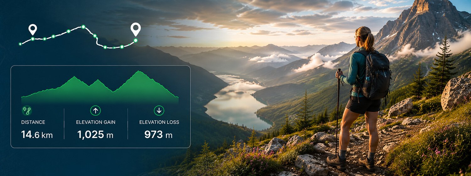
Plan your next hike with Map My Distance’s online hiking route planner. Create a hiking route directly on the map, calculate your distance as you go, check the elevation profile and adjust your route before heading out.
Whether you’re planning a short local hike, a challenging mountain route, a long day on the trails or exploring somewhere new, Map My Distance makes it easy to map your hiking route and understand what lies ahead.
Everything You Need to Plan Better Hikes
Map My Distance gives you the tools to map, measure and explore hiking routes before you hit the trail.
Map Your Hike
Create your hiking route by adding points directly to the interactive map.
Calculate Distance
See your total hiking distance update as you build and adjust your route.
Follow Roads & Paths
Snap your route to available roads and paths where routing data is available.
Check Elevation
View your elevation profile to understand the climbs and descents ahead.
Save Your Hikes
Save favorite hiking routes to your account and find them again later.
Share & Collaborate
Share hiking routes with friends or work together to plan an adventure.
Free To Use
Mark landmarks, meeting points and useful locations along your hiking route.
Works Worldwide
Plan hiking routes around the world where mapping and routing data is available.
How to Plan a Hiking Route
It only takes a few steps to start planning your next hiking adventure.
Choose Your Start
Find the area you want to explore and choose where your hike will begin.
Add Points
Add points along the roads and paths you want your hiking route to follow.
Check Distance & Elevation
Review your total distance and elevation profile as you plan.
Save & Go
Save your route, share it with your group and get ready to head outdoors.
Plan a Hiking Route Online
A good hiking route involves more than simply choosing where you want to go.
Distance, elevation and the shape of your route can all affect how demanding a hike may be. Planning beforehand gives you a better understanding of the route before you head outdoors.
With the Map My Distance hiking route planner, you can build your route directly on an interactive map. Choose your starting point and add points along the roads and paths you want to follow.
As you build your route, Map My Distance calculates the total distance, allowing you to extend, shorten or change your planned hike.
You can also view the elevation profile to see where climbs and descents occur along the route.
Whether you’re planning a short local hike or a longer adventure through unfamiliar terrain, having the route mapped beforehand gives you a much clearer picture of what you’ve planned.
Map Your Hiking Route
Map My Distance makes it easy to turn an idea for a hike into a route you can actually see and measure.
Start by finding the area you want to explore on the map. Choose where your hike will begin and add points along the route you want to take.
Your hiking route appears as you build it, with the total distance updating as you go.
If the hike looks too short, you can extend it. If you’ve planned farther than you intended, adjust your route until you reach a more suitable distance.
You can use Map My Distance to plan:
- Local hiking routes
- Mountain hikes
- Weekend adventures
- Longer day hikes
- Circular hiking routes
- Group hikes
- Training hikes
- Hiking event routes
- Routes while travelling
- New trails and areas to explore
Being able to experiment with the route before you leave makes it easier to compare different options and plan an adventure that suits what you’re looking for.
Calculate Your Hiking Distance
Distance is one of the first things you’ll probably want to know when planning a hike.
Map My Distance works as a hiking distance calculator, measuring your route as you create it on the map.
Every time you add, remove or adjust part of the route, your total distance updates.
This means you can quickly compare different route ideas or create a hike around a particular target distance.
You might want a short 5 km hike for the morning, a 10 km route for the afternoon or a considerably longer adventure for a full day outdoors.
You can also create circular routes that return to your starting point and adjust the loop until it reaches roughly the distance you’re looking for.
Distances can be viewed in kilometres or miles depending on your preference.
Check the Elevation of Your Hiking Route
For hiking, distance only tells you part of the story.
A 10 km route through relatively flat terrain can be very different from a 10 km hike that involves repeated steep climbs and descents.
Map My Distance lets you view an elevation profile for your hiking route, helping you see how the elevation changes as you progress along your planned hike.
This can be particularly useful when you’re:
- Planning a mountain hike
- Looking for a less hilly route
- Preparing for a challenging hiking event
- Comparing two possible routes
- Planning a longer day hike
- Adding climbing to your training
- Exploring an unfamiliar area
Looking at distance and elevation together can give you a much better understanding of the physical challenge involved in the route you’ve mapped.
I’d make elevation particularly prominent on this page. It’s relevant on Running, Cycling and Walking, but Hiking gives you an especially strong reason to talk about it in detail.
Plan Circular Hiking Routes
A circular hike can be a convenient way to explore an area while finishing back where you started.
With Map My Distance, you can create a loop by mapping your route away from your starting point before bringing it back around to the same area.
Your hiking distance updates as the loop grows, making it easy to experiment with different routes.
If your planned loop is too short, add another section. If it’s becoming longer than you want, adjust the route until it better suits your plans.
Circular routes can be particularly useful when you’re driving to the start of a hike, meeting a group at one location or simply want to avoid retracing the same route back.
Follow Roads and Paths
Hiking routes often involve more twists and turns than a simple straight line between two locations.
Map My Distance includes route snapping to help your planned hike follow available roads and paths where the necessary routing data is available.
This makes it easier to create routes that reflect the shape of the mapped paths you’re planning to follow.
You remain in control of the route, so you can add more points or make adjustments when you want your hike to take a different direction.
Because mapping and routing coverage varies by location, I’d avoid claiming that MMD contains every hiking trail or knows whether a particular trail is accessible or suitable. That’s an important distinction for this page.
Understand the Terrain Before You Go
The terrain you encounter can make a big difference to a hike.
While a map gives you a useful overview of where your route travels, the elevation profile provides another perspective by showing how the height of the route changes along the way.
You may discover that most of the climbing happens near the beginning of your hike, that there’s a significant climb towards the end, or that what looked like a straightforward route involves repeated elevation changes.
This information can help when comparing possible hiking routes.
For example, two routes might cover almost exactly the same distance but have very different elevation profiles.
Understanding those differences before choosing your route can help you select the hike that better matches the kind of adventure you’re planning.
Plan Hiking Routes for Training
Hiking itself can be the goal, but it can also form part of your training for a larger adventure.
If you’re preparing for a long-distance hike, mountain event or another outdoor challenge, you can use Map My Distance to create routes with different combinations of distance and elevation.
Start with shorter routes and gradually create longer hikes as your training progresses.
If climbing is an important part of what you’re preparing for, look at the elevation profile and experiment with routes that include more hills.
You can save different training routes to your account, giving you a selection of hikes for different distances and types of sessions.
Add Points of Interest to Your Hiking Route
Longer hiking adventures often involve useful locations that you may want to remember.
Map My Distance lets you add points of interest to your route, helping you mark locations that matter to your plans.
These might include:
- Meeting points
- Landmarks
- Viewpoints
- Route junctions
- Planned stops
- Other useful locations
This can be particularly helpful when planning an unfamiliar route or organising a hike with other people.
Instead of keeping your route and useful locations separate, you can include them as part of your overall route plan.
I like this section particularly for Hiking because POIs have a much stronger natural use case here than on some of the other activity pages.
Plan a Hike Somewhere New
One of the best parts of hiking is discovering somewhere you’ve never explored before.
Map My Distance can help you start planning before you arrive.
Find your destination on the map, create a possible hiking route and use the distance and elevation information to understand what you’ve mapped.
You can experiment with different routes, compare distances and see how changing the route affects its elevation profile.
This can be useful whether you’re planning a hiking trip away from home or simply looking for somewhere new to explore nearby.
And because Map My Distance provides worldwide mapping coverage, you can start investigating possible routes in destinations around the world where the required mapping and routing data is available.
Save Your Favourite Hiking Routes
Some hikes are worth doing more than once.
Save your favourite hiking routes to your Map My Distance account so you can easily find them again later.
You could build a collection of routes for different distances, areas and types of adventure.
For example, you might save a short local trail for when you only have a couple of hours, a longer weekend hike, a challenging route with more elevation and several routes you’ve planned for future trips.
Having them stored in one place means you don’t have to recreate the route every time you want to revisit it.
Share Hiking Routes With Friends
Planning an adventure with other people can involve plenty of discussion about where to go.
Map My Distance lets you share hiking routes with friends so everyone can see the proposed route.
This can be useful for hiking groups, friends planning a weekend adventure or people preparing for an outdoor event together.
Map My Distance also supports collaborative route planning, allowing people to work together on a route.
If someone has another idea for part of the hike, the route can be adjusted rather than trying to explain the change through messages or screenshots.
Explore New Hiking Routes
You don’t always need to travel somewhere far away to find a new adventure.
A hiking route planner can be a useful way to explore the map around places you already know.
Look at an existing route and see whether you can extend it into a longer loop. Explore another path in the area. Compare the distance and elevation of different options.
If you’re planning a trip, you can also start exploring the destination beforehand and save possible hiking routes for later.
Over time, you can build a collection of routes covering everything from quick local hikes to much bigger outdoor adventures.
Why Use Map My Distance?
Planning a hiking route before you head out helps you understand where you’re going, how far you’ve planned to travel and how the elevation changes along the way.
Map My Distance brings route mapping, distance calculation, elevation profiles, route snapping, points of interest, saving and sharing together in one online hiking route planner.
- Map your hiking route before heading outdoors.
- Measure distance and understand the elevation ahead.
- Explore new trails, routes and places to hike.
- Save favourite hikes and useful points of interest.
- Share routes or plan adventures together with friends.
Hiking Route Planner FAQs
Some frequently asked questions on hiking route planners.
Explore More
More tools and guides to help you train smarter.
Map Your Route
Start mapping out your route on Map My Distance.
Running Calculator
Plan run routes and calculate distance and elevation.
Cycling Calculator
Plan bike rides and measure total distance.
Our Blog
Explore route planning tips, guides and running advice.